
Hudspeth County, Texas: A Forgotten Frontier for Serious Travelers
Hudspeth County is not the kind of destination that makes travel easy. It has no famous entertainment district, large resort […]
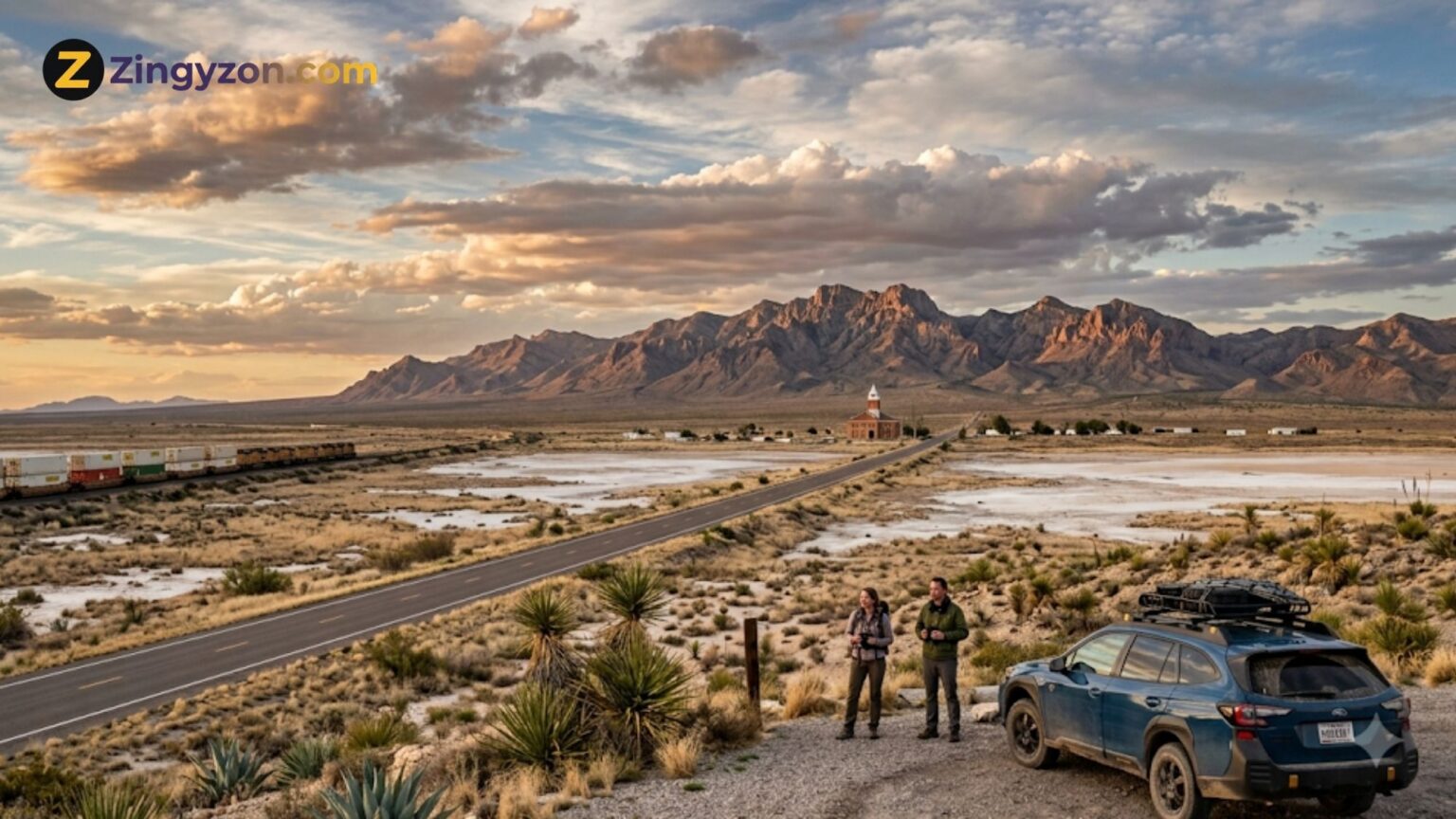
Hudspeth County is not the kind of destination that makes travel easy. It has no famous entertainment district, large resort zone, or tightly organised sightseeing circuit. Its attractions are spread across an immense desert landscape where fuel stations, restaurants, accommodation, and mobile-phone reception can be separated by long distances.
That is also what makes it fascinating.
Located in the Trans-Pecos region of far-western Texas, Hudspeth County borders New Mexico to the north and Mexico to the south. It covers more than 4,500 square miles of terrain ranging from broad desert basins to rugged mountains, yet its communities remain small and widely separated. Interstate 10 crosses the southern part of the county, while US Highways 62 and 180 provide access through the north.
This is a place for travellers who value silence, landscape, history, and the experience of moving through country that has not been redesigned for tourism. A successful visit requires preparation, patience, and respect for private land, local communities, severe weather, and the realities of travelling near an international border.
For serious travellers, Hudspeth County offers something increasingly rare: the feeling of being far away without leaving the United States.
Why Hudspeth County Feels Like a Forgotten Frontier
Much of Hudspeth County appears almost empty from the road. Desert plains stretch towards isolated mountain ranges, freight trains cross the horizon, and settlements can seem unexpectedly small compared with the enormous landscape around them.
The county government describes the area through its expansive desert terrain, mountain views, ranching connections, borderland culture, frontier history, and peaceful rural character.
The county’s apparent emptiness should not be confused with an absence of history. Indigenous communities used local springs and river corridors long before European exploration. Spanish expeditions crossed the region during the sixteenth and seventeenth centuries, while wagon routes, stagecoaches, military patrols, railways, ranching, mining, agriculture, and international migration later shaped the area.
Hudspeth County is therefore best understood as a cultural landscape rather than a collection of conventional attractions. The highways, abandoned structures, mountain passes, cultivated valleys, railway lines, and old water sources all reveal part of its story.
Visitors willing to slow down will find that the landscape becomes the main attraction.
Sierra Blanca: The County’s Historic Crossroads
Sierra Blanca is the county seat and one of the most useful bases for exploring southern Hudspeth County. It developed after the Southern Pacific and Texas and Pacific railways met near Sierra Blanca Mountain in 1881, completing an important transcontinental rail connection.
The town still feels closely connected to transportation. Interstate 10, railway infrastructure, local roads, and the surrounding desert make Sierra Blanca a natural stopping point between El Paso and communities farther east.
Its most significant historic structure is the Hudspeth County Courthouse. The Texas State Historical Association identifies it as the only Texas county courthouse built entirely from adobe, making it an unusual piece of regional architecture.
Sierra Blanca is not a polished tourist town. Services can be limited, and visitors should verify current opening hours before depending on a particular restaurant, shop, or fuel stop. Its value lies in atmosphere, history, and location rather than a long list of attractions.
Spend time observing the mountain views, railway landscape, courthouse area, and changing desert light. Sunrise and sunset can transform otherwise muted terrain into layers of gold, red, purple, and deep blue.
Salt Flat and the Northern Desert
The northern part of Hudspeth County offers some of its most dramatic scenery. The community of Salt Flat sits along US 62 and US 180 near the Salt Basin and the western side of Guadalupe Mountains National Park.
This region feels especially remote. Pale desert surfaces contrast with dark mountain walls, while the scale of the open land can make vehicles and buildings appear tiny.
The Salt Basin has played an important role in regional history. Indigenous peoples used the area, and salt gathering later became economically and politically significant for communities near the Rio Grande. Disputes over control of the salt deposits contributed to the nineteenth-century conflict known as the San Elizario Salt War.
Today, the landscape attracts photographers, geologists, hikers, road-trippers, and travellers interested in places shaped by natural resources.
Visiting the Salt Basin Dunes
The Salt Basin Dunes are part of Guadalupe Mountains National Park and provide one of the most visually striking experiences near Hudspeth County. The white gypsum dunes rise as high as approximately 100 feet from the desert floor, creating a bright foreground beneath the darker cliffs of the Guadalupe Mountains.
Reaching the dunes requires more planning than visiting the park’s main Pine Springs area. Access roads and trail conditions should be checked on the National Park Service website before departure. The site is remote, shade is limited, and summer temperatures can become dangerous.
Bring more water than you expect to need, sun protection, appropriate footwear, a paper or offline map, and emergency supplies. Tell another person where you are going and when you expect to return.
The dunes are particularly impressive during early morning and late afternoon, when low sunlight creates stronger shapes and shadows. Visitors should remain on authorised routes, avoid damaging fragile surfaces, and follow all National Park Service regulations.
Guadalupe Mountains National Park observes Mountain Time even though nearby parts of Texas may create confusion for phone-based time settings. Confirm the local time when planning hikes, sunset photography, or meetings.
Dell City and the Agricultural Desert
Dell City offers a different view of Hudspeth County. Located in the county’s northeastern section, it developed after groundwater discoveries encouraged agricultural expansion during the mid-twentieth century.
Farming in this environment has always involved a difficult relationship with water. Historical accounts describe how intensive pumping lowered the water table after agricultural development expanded, demonstrating how fragile desert resources can be.
The contrast between irrigated fields and surrounding desert is one of the area’s most interesting visual features. It reveals the effort required to maintain agriculture in one of Texas’s driest regions.
Dell City should be approached as a living community rather than an attraction created for outsiders. Drive carefully, respect agricultural operations, avoid entering fields or private roads, and support local businesses when they are open.
The town can serve as a gateway for travellers exploring the northern county, but accommodation and dining options should be confirmed before arrival.
Fort Hancock and the Rio Grande Corridor
Fort Hancock lies in the county’s southwestern section near the Rio Grande. The community grew from the wider history of military routes, rail transport, border agriculture, and settlement along the river.
The area demonstrates how the Rio Grande supports life within an otherwise dry environment. Farms, irrigation infrastructure, roads, railway lines, and small settlements follow the river corridor, creating a landscape different from the higher desert around Sierra Blanca and Salt Flat.
Travellers should remember that this is an active border region, not a themed frontier attraction. Remain on public roads, obey signs and barriers, carry appropriate identification, and never enter private farms, ranches, canals, or restricted areas.
Border enforcement activity may be visible during the journey. Treat officers and local residents respectfully, answer lawful questions clearly, and avoid creating unnecessary problems by exploring unsigned tracks or attempting shortcuts near the international boundary.
The Story of Indian Hot Springs
Indian Hot Springs is one of the county’s most historically important but frequently misunderstood locations. The Texas site consists of a cluster of seven geothermal springs near the Rio Grande, south of Sierra Blanca. The springs were used by Indigenous peoples and later became associated with military history, health tourism, and settlement.
A commercial health resort was established during the late 1920s, with a hotel, cabins, bathhouse, and other structures. The resort closed during the Second World War, and the wider cultural landscape was later recognised for its archaeological and historic significance.
The area is also connected to Buffalo Soldier history. In 1880, members of the 10th United States Cavalry were attacked near the springs during military operations involving Apache fighters. Accounts differ on some details, but several soldiers were killed and buried in the area.
Most importantly for modern travellers, the Texas Indian Hot Springs property is privately owned. Texas Time Travel warns that many surrounding roads and properties are private and should be avoided. Visitors must not enter the old resort, approach buildings, cross gates, or attempt to soak in the springs without explicit permission.
Do not confuse this historic Texas site with the operating Colorado resort discussed in this Indian Hot Springs review. Travellers researching publicly accessible thermal pools elsewhere in the United States can explore the wider guides published by Soak Destinations.
In Hudspeth County, Indian Hot Springs should be appreciated primarily through documented history and authorised public viewpoints rather than trespassing.
What Makes Hudspeth County Suitable for Serious Travelers?
Hudspeth County rewards curiosity but offers little protection from poor planning. Travellers must take responsibility for their vehicle, water, navigation, timing, and weather decisions.
It is best suited to people who enjoy:
- Remote scenic drives
- Desert and landscape photography
- Frontier, railway, military, and borderland history
- Geology and natural history
- Quiet communities without mass tourism
- Dark skies and open horizons
- Self-planned road trips
- Places that require research and patience
It may not suit travellers who expect frequent restaurants, luxury accommodation, organised tours, reliable mobile reception, or attractions operating on fixed daily schedules.
The county is not empty, abandoned, or waiting to be discovered. People live and work here. Serious travel means recognising that visitors are guests within ranching, farming, railway, Indigenous, Hispanic, and borderland landscapes.
When Is the Best Time to Visit?
Autumn, winter, and early spring are generally the most comfortable seasons for exploring Hudspeth County. Daytime conditions can be pleasant, although nights may become cold, particularly at higher elevations.
Summer travel requires much greater caution. The region is arid, exposed, and capable of extreme heat. The National Weather Service regularly issues heat alerts covering Hudspeth County, including the Lower Valley, Salt Flat, and Dell City areas.
The summer monsoon can also produce sudden thunderstorms and flash flooding. A dry road or crossing can become dangerous quickly, even when rain is falling several miles away.
Check forecasts immediately before travel rather than relying on seasonal assumptions. Avoid hiking during the hottest part of the day, never drive through floodwater, and postpone remote trips when warnings are active.
Essential Driving Preparation
Your vehicle is the most important piece of travel equipment in Hudspeth County.
Before leaving El Paso, Van Horn, Carlsbad, or another larger service centre, check the tyres, spare tyre, coolant, battery, lights, and fuel level. Do not assume the next town will have an open repair shop or petrol station.
Carry:
- Several litres of drinking water per person
- Food that does not require refrigeration
- A properly inflated spare tyre
- Tyre-changing equipment
- Battery pack and charging cables
- First-aid supplies
- Torch or headlamp
- Warm layer, even outside winter
- Sun hat and sunscreen
- Printed or offline maps
- Emergency contact information
Check current highway closures, construction, flooding, and incidents through DriveTexas before beginning the journey. TxDOT notes that conditions can change quickly, particularly during poor weather.
Tell someone your intended route. Avoid unmarked dirt roads, particularly when travelling alone or in a standard passenger car. A navigation app may identify a track that crosses private property or becomes impassable.
A Two-Day Hudspeth County Road-Trip Plan
Day One: Sierra Blanca and the Southern County
Begin in Sierra Blanca, allowing time to see the historic courthouse and railway landscape. Purchase fuel, water, and supplies before continuing.
Follow authorised public routes towards Fort Hancock and observe how the terrain changes near the Rio Grande agricultural corridor. Research public historical markers in advance rather than attempting to reach ruins or springs on private land.
Return to Sierra Blanca or continue towards El Paso, depending on confirmed accommodation.
Day Two: Salt Flat and the Northern County
Travel north towards Dell City and Salt Flat. Stop only where parking is legal and safe; highway shoulders can be narrow or unstable.
Continue to the Salt Basin Dunes when the official access route is open and weather conditions are suitable. Allow generous time for the return drive and avoid beginning a desert hike late in the day.
Travellers can find more road-trip planning and lesser-known destination ideas on zingyzon.com.
Responsible Travel Rules
Most land in Hudspeth County is not public recreation land. A road appearing on a digital map does not automatically give visitors permission to use it.
Never cross a locked or closed gate. Do not enter abandoned-looking buildings, collect artefacts, remove rocks from protected areas, disturb livestock, fly drones without checking regulations, or publish directions to sensitive archaeological sites.
Take rubbish with you and avoid outdoor flames when fire restrictions are active. The county posts current announcements and burn-ban information on its official website.
Responsible behaviour protects local residents, historic sites, wildlife, and future access.
Frequently Asked Questions
Is Hudspeth County Worth Visiting?
Yes, for travellers interested in remote landscapes, West Texas history, scenic driving, photography, geology, and places beyond conventional tourism. It is less suitable for visitors expecting numerous organised attractions.
What Is Hudspeth County Known For?
The county is known for its Chihuahuan Desert terrain, mountain ranges, borderland history, railway development, ranching, agriculture, Sierra Blanca, and the Salt Basin region.
Can You Visit Indian Hot Springs in Texas?
The historic springs and resort property are privately owned. Travellers should not enter private roads or buildings and must follow all signs and access restrictions.
Are the Salt Basin Dunes in Hudspeth County?
The dunes are on the western side of Guadalupe Mountains National Park near Salt Flat and the Hudspeth–Culberson county region. Visitors should use official National Park Service directions and confirm road conditions before travelling.
Is Mobile Service Reliable?
Coverage can be inconsistent across remote desert areas. Download maps, addresses, booking details, and emergency information before leaving a larger town.
How Long Should You Spend in the County?
Two days provide time for Sierra Blanca and the northern Salt Flat area. Travellers interested in hiking, photography, or Guadalupe Mountains National Park may need three or more days.
Final Thoughts
Hudspeth County, Texas, is a forgotten frontier only in the sense that most travellers pass through without stopping. The land itself has not forgotten anything.
Its salt basins preserve stories of trade and conflict. Its springs carry Indigenous, military, and health-resort history. Its railway junctions recall westward expansion, while its farms reveal the difficult relationship between desert settlement and water.
This is not an effortless destination. Services are limited, distances are long, weather can be severe, and many historic places are located on private land. Those conditions demand preparation rather than discouraging travel.
For visitors who arrive responsibly, Hudspeth County provides an unusually powerful sense of space. It offers mountain silhouettes, empty highways, desert skies, historic communities, and the quiet awareness that some of America’s most meaningful landscapes remain far beyond the usual travel circuit.


Keep Exploring Zingyzon.com
Read more Zingyzon SEO, digital marketing, online earning, business, and technology guides for Australia, USA, and global readers.